
UGANDA
|
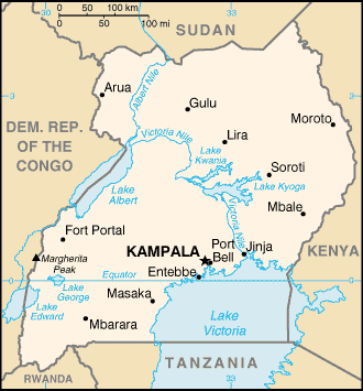
Location:
|
Eastern Africa, west of Kenya |
|
Geographic coordinates:
|
1 00 N, 32 00 E |
|
Map references:
|
Africa |
|
Area:
|
total: 236,040 sq km land: 199,710 sq km water: 36,330 sq km |
|
Area - comparative:
|
Slightly smaller than Oregon |
|
Land boundaries:
|
total: 2,698 km border countries: Democratic Republic of the Congo 765 km, Kenya 933 km, Rwanda 169 km, Sudan 435 km, Tanzania 396 km |
|
Coastline:
|
0 km (landlocked) |
|
Climate:
|
Tropical; generally rainy with two dry seasons (December to February, June to August); semiarid in northeast |
|
Terrain:
|
Mostly plateau with rim of mountains |
|
Elevation extremes:
|
lowest point: Lake
Albert 621 m highest point: Margherita Peak on Mount Stanley 5,110 m |
|
Natural resources:
|
copper, cobalt, hydropower, limestone, salt, arable land |
|
Land use:
|
arable land: 25.88% permanent crops: 10.65% other: 63.47% (2001) |
|
Irrigated land:
|
90 sq km (1998 est.) |
|
Natural hazards:
|
NA |
|
Environment - current issues:
|
Draining of wetlands for agricultural use; deforestation; overgrazing; soil erosion; water hyacinth infestation in Lake Victoria; poaching is widespread |
|
Population:
|
26,404,543 note: estimates for this country explicitly take into account the effects of excess mortality due to AIDS; this can result in lower life expectancy, higher infant mortality and death rates, lower population and growth rates, and changes in the distribution of population by age and sex than would otherwise be expected (July 2004 est.) |
|
Age structure:
|
0-14 years: 50.6%
(male 6,696,193; female 6,653,764) 15-64 years: 47.1% (male 6,199,732; female 6,233,678) 65 years and over: 2.4% (male 269,990; female 351,186) (2004 est.) |
|
Median age:
|
total: 14.8 years male: 14.7 years female: 14.9 years (2004 est.) |
|
Population growth rate:
|
2.97% (2004 est.) |
|
Birth rate:
|
46.31 births/1,000 population (2004 est.) |
|
Death rate:
|
16.61 deaths/1,000 population (2004 est.) |
|
Net migration rate:
|
0 migrant(s)/1,000 population note: according to the UNHCR, by the end of 2001, Uganda was host to 178,815 refugees from a number of neighboring countries, including: Sudan 155,996, Rwanda 14,375, and Democratic Republic of the Congo 7,459 (2004 est.) |
|
Sex ratio:
|
at birth: 1.03 male(s)/female under 15 years: 1.01 male(s)/female 15-64 years: 1 male(s)/female 65 years and over: 0.77 male(s)/female total population: 1 male(s)/female (2004 est.) |
|
Infant mortality rate:
|
total: 86.15
deaths/1,000 live births male: 93.58 deaths/1,000 live births female: 78.5 deaths/1,000 live births (2004 est.) |
|
Life expectancy at birth:
|
total population:
45.28 years male: 43.76 years female: 46.83 years (2004 est.) |
|
Total fertility rate:
|
6.64 children born/woman (2004 est.) |
|
HIV/AIDS - adult prevalence rate:
|
4.1% (2003 est.) |
|
HIV/AIDS - people living with HIV/AIDS:
|
600,000 (2001 est.) |
|
HIV/AIDS - deaths:
|
84,000 (2001 est.) |
|
Nationality:
|
noun: Ugandan(s) adjective: Ugandan |
|
Ethnic groups:
|
Baganda 17%, Ankole 8%, Basoga 8%, Iteso 8%, Bakiga 7%, Langi 6%, Rwanda 6%, Bagisu 5%, Acholi 4%, Lugbara 4%, Batoro 3%, Bunyoro 3%, Alur 2%, Bagwere 2%, Bakonjo 2%, Jopodhola 2%, Karamojong 2%, Rundi 2%, non-African (European, Asian, Arab) 1%, other 8% |
|
Religions:
|
Roman Catholic 33%, Protestant 33%, Muslim 16%, indigenous beliefs 18% |
|
Languages:
|
English (official national language, taught in grade schools, used in courts of law and by most newspapers and some radio broadcasts), Ganda or Luganda (most widely used of the Niger-Congo languages, preferred for native language publications in the capital and may be taught in school), other Niger-Congo languages, Nilo-Saharan languages, Swahili, Arabic |
|
Literacy:
|
definition: age 15 and
over can read and write total population: 69.9% male: 79.5% female: 60.4% (2003 est.) |
|
Telephones - main lines in use:
|
61,000 (2003) |
|
Telephones - mobile cellular:
|
776,200 (2003) |
|
Telephone system:
|
general assessment:
seriously inadequate; two cellular systems have been introduced, but a
sharp increase in the number of main lines is essential; e-mail and
Internet services are available domestic: intercity traffic by wire, microwave radio relay, and radiotelephone communication stations, fixed and mobile cellular systems for short-range traffic international: country code - 256; satellite earth stations - 1 Intelsat (Atlantic Ocean) and 1 Inmarsat; analog links to Kenya and Tanzania |
|
Radio broadcast stations:
|
AM 7, FM 33, shortwave 2 (2001) |
|
Television broadcast stations:
|
8 (plus one low-power repeater) (2001) |
|
Internet country code:
|
.ug |
|
Internet hosts:
|
2,692 (2004) |
|
Internet users:
|
125,000 (2003) |
|
Railways:
|
total: 1,241 km narrow gauge: 1,241 km 1.000-m gauge (2003) |
|
Highways:
|
total: 27,000 km paved: 1,809 km unpaved: 25,191 km (1999 est.) |
|
Waterways:
|
300 km (on Lake Victoria, 200 km on Lake Albert, Lake Kyoga, and parts of Albert Nile) (2004 est.) |
|
Ports and harbors:
|
Entebbe, Jinja, Port Bell |
|
Merchant marine:
|
total: 3 ships (1,000
GRT or over) 5,091 GRT/5,943 DWT by type: roll on/roll off 3 (2003 est.) |
|
Airports:
|
27 (2003 est.) |
|
Airports - with paved runways:
|
total: 4 over 3,047 m: 3 1,524 to 2,437 m: 1 (2004 est.) |
|
Airports - with unpaved runways:
|
total: 25 2,438 to 3,047 m: 1 1,524 to 2,437 m: 6 914 to 1,523 m: 11 under 914 m: 7 (2004 est.) |